
The Gardens: Foraster

Unlike the other Gardens, the Forester Garden is located in the relatively flat and fertile land of the valleys. The garden is at top of the valley, just down the hill from the town of Senan. In this dry and hilly region, minor differences in moisture content and slope are valuable, and farmers often plant the gently sloping land in the valleys with cereal grains and other economically viable crops. When farmed intensively, these sites can generate some income for the landowners, and they are rare in our research project, which, by necessity, focuses on marginal land.


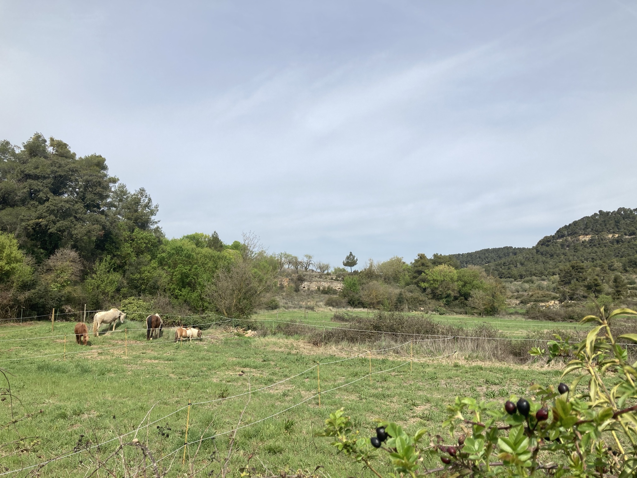
Images showing the existing condition of the garden in June. The second photo clearly shows the distinction between the fields that were producing creals and the stone wall covered in Hedera helix and other plants. Photos by Chair of Being Alive
Although located in a valley, the valley has no river, or even a stream. The Gaussen diagram for Senan shows that the region is dry, with peaks of precipitation in the autumn and spring. When it rains in Senan, it often rains heavily, and, over time, erosion from rainstorms carved the valleys. Today, the rainwater flows into system of subterranean drains, called albellos. These stone drainage channels flow along the low point of the valleys and drain the fields during storms. This invisible infrastructure system is only apparent when it fails. The Forester Garden consists of five stepped fields terraced by stone walls with a subterranean drain running down the center. The drain and the walls are the inherited landscape structure developed over generations in order to productively farm in this region.

The garden is the only plot that was recently farmed. This results in a vegetation of grasses and herbaceous plants in the center of the fields, and shrubs and vines like Hedera helix along the stonewalls. The soil tests show a relatively deep soil of over 100 cm. There is no O horizon with undecomposed or humified organic matter on the ground, but there are two distinct A and B soil horizons. Ironically, one of the fields was filled with a thin layer of stone building debris, and this sits above the deeper soil. The vegetation community is representative of the plants that appear in fields left fallow. Using resources such as the Les Plantes Bioindicadores, it is possible to read the composition of species that appear as indicators of the soil condition. Farmers can read these plants and adjust inputs and cropping patterns. Each garden contains a 10x20m test plot that is closely monitored prior, during and after the intervention in order to document changes to the soil and vegetation. The test plot is situated in an area typical of the site, crossing a stone wall between two fields. This page contains more information about the test plot and the vegetation survey.
We divide the garden into evenly sized plots, each of which will support the herd of horses for one day. The distribution of the plots follows the existing logic of the terraces, with access occurring along an existing path on the south side. There are Islands on some of the stone walls. These areas are fenced from the horses and planted with fruit trees and berries that cannot be grazed but benefit from the soil that we predict will improve following the PRV management system.
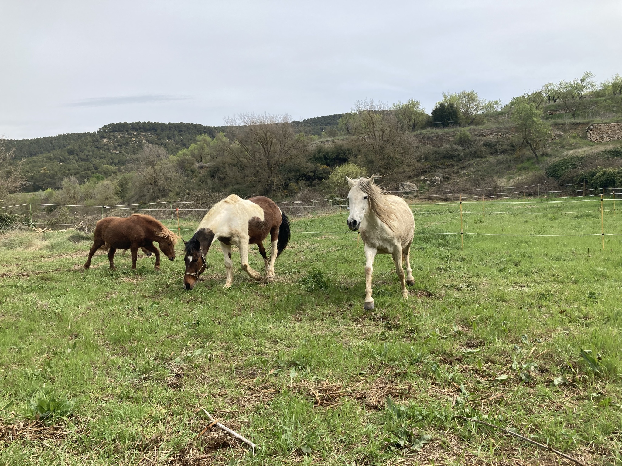

The first horses arrive at the Forester Garden at the end of April, 2022. Photo Chair of Being Alive


