Senan: Geology & Soil
GEOLOGY

The site is located in the Serra del Tallat mountain range in the Ebro Basin. The Ebro basin is a foreland basin formed to the south of the Pyrenees which mark its northern border. The southern edge is defined by the Catalan Coastal Ranges. The Erbo Basin was a marine basin connecting to the Atlantic Ocean and Mediterranean Sea in the Paleogene, but the outflows were severed in the Late Eocene.

The surface geology mirrors the topography of the region. The downstream valley bottoms consist of Holocene era fluvial deposits. Further upstream, and including the lower slopes of the surrounding ridges are fine-grained clays, silts and sandstone with insertions of conglomerates, sandstone, and limestone deposited during the Oligocene epoch. Upslope, the majority of the ridges are made up of micritic limestone (stone made up of very fine mud) with layers of grey marl and silts. Lastly, the highest ridgetops contain marls and clays with layers of sandstone and limestone. Looking at the whole, it is clear how erosion has revealed the layers deposited over time, creating a mosaic of rock types that follows the topography.


Exposed layers of stone, Senan, Chair of Being Alive
SOIL
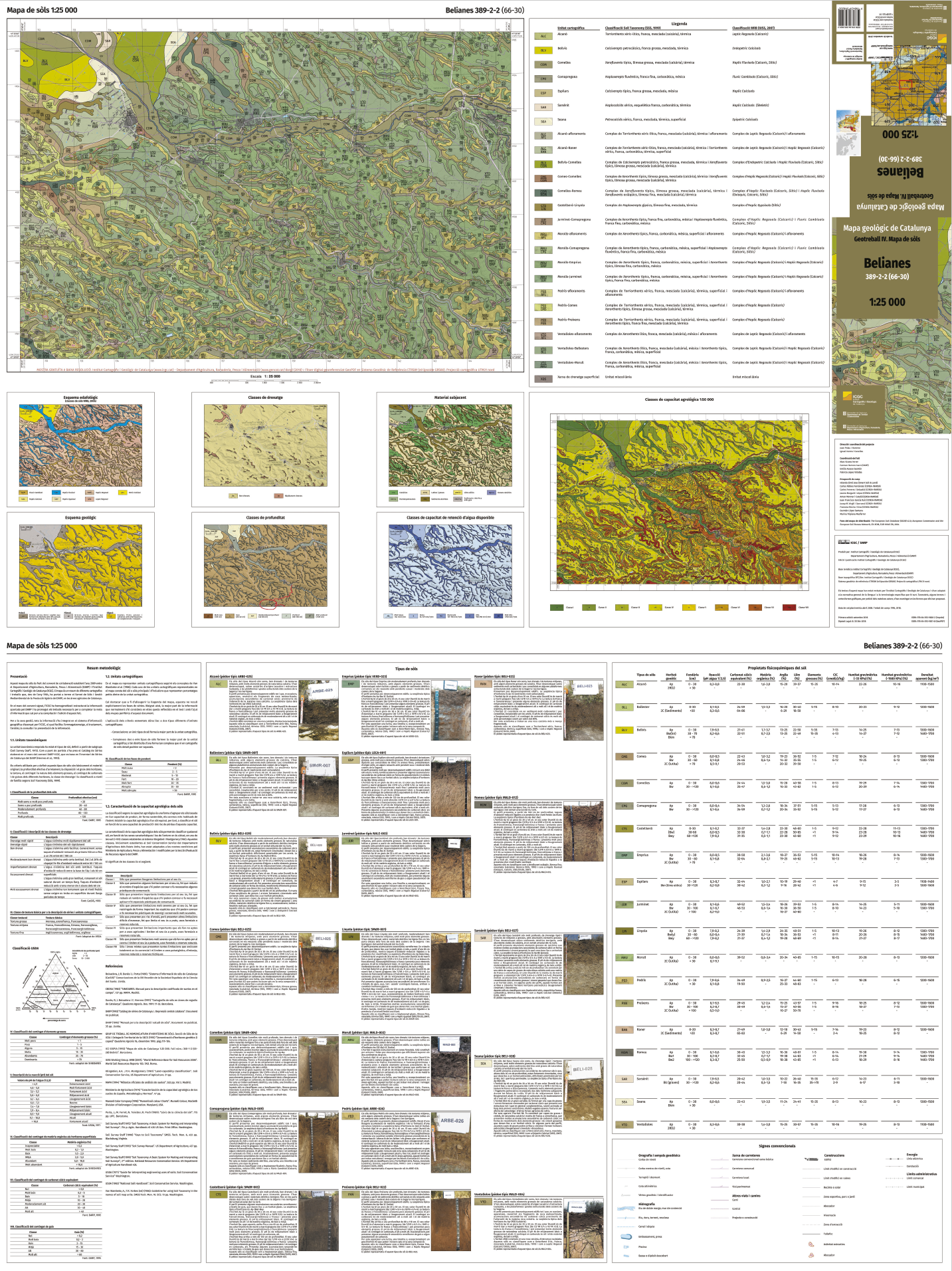
The geology shapes the soils of the region. The Institut Cartogràfic i Geològic de Catalunya (ICGC) defines two soils in the region. This classification is very broad, and, as we know from the geological map, the rock types are not homogeneous. Unfortunately, this is the most detailed soil map of the area, but the ICGC produced a more detailed map for the region immediately to the north (Belianes), and, since the topographical and geological pattern is consistent, we have interpolated the data for the region around Senan.
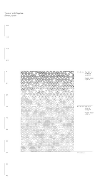
Following the ICGC classification, we have identified three soils that likely occur in our area. The first soil, which occurs at the valley bottom, is the Comapregona soil (CPG), which is a deep, well-drained, basic, poorly developed soil formed at the base of slopes. The A horizon is 30 to 40cm thick and the texture is a loam, silt loam or a silty clay loam with an organic matter content of 1.5 to 2.5%. The B horizon has the same texture, but is deeper, ranging from 30 to 120cm, with minimal organic matter. The second typical soil is the Emprius soil (EMP) which is a moderately deep, well-drained, basic and poorly developed soil typically occurring on gentle to moderate slopes. It is a colluvial soil that developed from mudstones and limonites. The A horizon is 20-30cm thick with a loam or silt loam texture and an organic matter content of 2.0 to 3.5%. The B horizon is 30 to 50cm thick with a loam, silt loam or a silty clay loam texture and less organic matter. Lastly, the third typical soil is the Morull soil (MRU). It is shallow, well-drained, poorly developed and basic. It occurs on the ridges above mudstones and limonites. A 2cm O horizon of needles and leaves can occur in forested areas. The A horizon is 20 to 40 cm thick and the texture is loam, silt loam or a silty clay loam with an organic matter content of 0.8 to 3.5%. It may contain stones and gravel from the weathering of the mudstones and sandstones. There is no B horizon.

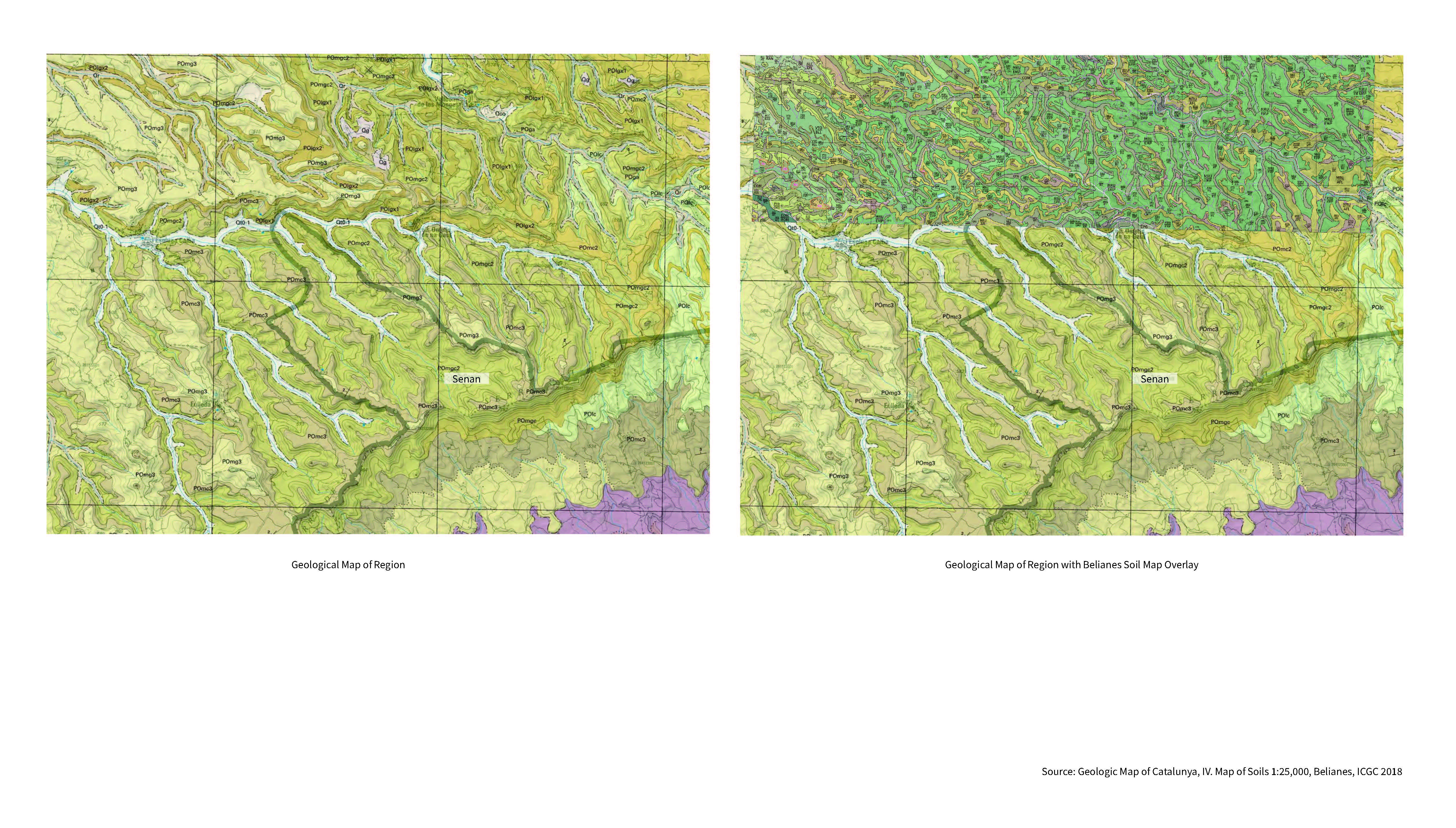


These maps show the process of extrapolating the more detailed maps of Belines to the area around Senan using an overlay of the geology and soil maps. From this process, we identified three soil types that are likely to occur in the region. Source ICGC
These three soils, the Comapregona, the Emprius and the Morull, became the typological soils for the project. When conducting fieldwork and analysis, we compare the soils we encounter to the typological soils in order to understand how a specific site relates to the larger landscape. We drew these three soil profiles in the soil langauge that has been developed at the Chair of Being Alive in order to compare their properties. It is possible to see clear differences, such as the limited depth and O horizon of the Morull soil, and the differentiation between the A and the B horizons in the Comapregona and Emprius soils.